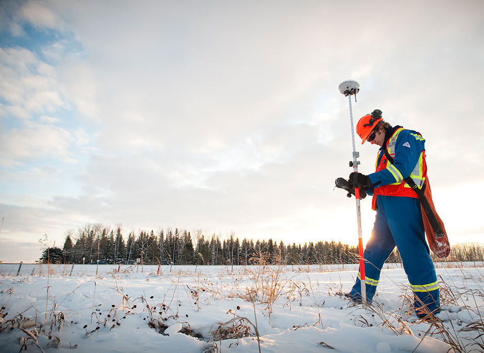
Land surveying is a significant aspect of every construction or development project that cannot be overlooked. Its importance stems from the fact that it encompasses the meticulous measurement and mapping of land, providing an abundance of accurate data concerning boundaries, topography, and various other essential features that are integral to the success of any project. This invaluable information plays a pivotal role in enabling engineers and developers to meticulously plan and deftly execute their projects in a highly efficient manner, thereby ensuring optimum results.
The Role of Land Surveying in Construction Projects
Ensuring Accurate Boundary Determination
An essential part of property management is the proactive prevention of encroachments. Encroachments refer to unauthorized intrusions or trespasses onto a property from neighboring properties, such as encroaching structures or unauthorized use of land. Property managers must constantly monitor and inspect the boundaries of their properties to identify and rectify any encroachments promptly. By taking preventative measures such as regular property inspections and open lines of communication with neighboring property owners, property managers can effectively minimize the chances of encroachments occurring. On occasion, an encroachment agreement must be drawn up by a lawyer to ensure both parties (owners of each property) are in agreement. For example, a garage overhang may encroach on city property by two feet. The city and the property owner must have an encroachment agreement prior to construction.
Topographic Mapping for Site Planning
Identifying and analyzing both natural and man-made features present within the land area under consideration is a crucial step in the assessment process. By thoroughly examining and documenting such features, ranging from geological formations and vegetation to infrastructure and existing structures, a more comprehensive understanding of the overall landscape can be achieved, which in turn aids in making informed decisions regarding potential construction activities.
More specifically, determining the drainage patterns and potential flood zones within a specific area is an essential aspect of land analysis. This process involves thoroughly studying and mapping the natural flow of water, drainage systems, and any potential sources of flooding, such as nearby rivers, lakes, or low-lying areas. By carefully analyzing these factors, a comprehensive understanding of the site's drainage characteristics can be obtained. This knowledge is critical for effectively planning and implementing appropriate drainage systems, ensuring that potential flood risks are minimized and managed efficiently.
Land Surveying Techniques and Tools
Global Positioning System (GPS)
One method that enhances accuracy and efficiency in surveying is by utilizing satellite signals for precise positioning. With the advent of GPS technology, surveyors are able to collect highly accurate data on latitude, longitude, and elevation. By tapping into this advanced satellite network, surveyors can ensure that their measurements are incredibly precise, which is crucial for numerous applications in fields such as construction, land development, and environmental monitoring. This technology has revolutionized the surveying industry, allowing for more efficient data collection and analysis. Additionally, it significantly reduces the time and effort required for gathering accurate spatial information. With the help of satellite signals, surveyors can confidently produce detailed maps, accurate land boundaries, and highly reliable geospatial data for a wide range of projects. Thus, leveraging the power of satellite signals not only enhances accuracy but also greatly increases the overall efficiency of surveying processes.
Total Station
Combining the cutting-edge technologies of electronic distance measurement and theodolite, our advanced system possesses the ability of accurately measuring both angles and distances with an extremely high level of precision. By seamlessly integrating these two powerful technologies, comprehensive and detailed survey real time data is generated and readily accessible to our clients.
LiDAR (Light Detection and Ranging)
One specific field where laser pulses have proven to be ideal is in large-scale mapping and aerial surveys. With the ability to accurately measure distances and capture detailed data on terrain, vegetation, and structures, laser technology has facilitated the creation of highly precise and extensive maps and surveys. This technology enables surveyors and cartographers to efficiently gather essential information, leading to comprehensive and reliable mapping results on a large scale. This has significantly enhanced the efficiency and accuracy of large-scale mapping and aerial surveys, making it an ideal tool for various industries and applications.
The Importance of Professional Land Surveyors
Expertise in Legal and Regulatory Requirements
One of our key strengths lies in our ability to thoroughly understand and comprehensively analyze the intricacies and specifics of local zoning laws and building codes. These laws and codes, which vary depending on the jurisdiction, encompass a vast range of regulations that govern the usage and development of land within a particular area. By having an in-depth knowledge of these regulations, we can provide our clients with valuable insights and guidance on how to navigate through the complex maze of rules and regulations, ensuring that their land use and development plans are in full compliance with the law.
Another area where we excel is in ensuring meticulous adherence and strict compliance with subdivision regulations. These regulations, which are often multi-faceted and complex, are a set of guidelines and requirements that govern the division and development of land into separate parcels or lots. We recognize the importance of adhering to these regulations and understand the significant impact they can have on the success of a development project. By ensuring strict compliance with these regulations, we can help our clients avoid potential legal issues and ensure that their development projects proceed smoothly and in accordance with the law.
In addition to our expertise in zoning laws, building codes, and subdivision regulations, we also offer esteemed expertise and professional experience in providing testimonial evidence and authoritative opinions in legal disputes. This is particularly relevant within the realm of land use and development, where conflicts often arise over various issues such as zoning changes, land ownership disputes, or compliance with regulations. Our team of experts is well-versed in the intricacies of these legal disputes and can provide valuable insights and expert opinions to assist in resolving these conflicts and determining the best course of action in a fair and just manner. With our assistance, our clients can navigate through the complexities of legal disputes and find satisfactory resolutions that align with their goals and interests.

Land Survey in Edmonton, Alberta
Accuracy and Precision in Data Collection
Through the implementation of advanced surveying techniques and the utilization of cutting-edge tools, we can deliver survey data that is not only reliable and accurate, but also precise to the highest degree.
Collaboration with Other Professionals
In order to guarantee a comprehensive and well-informed project planning and design process, we provide indispensable and detailed information, serving as a valuable resource for developers. This information covers various aspects and intricacies of the project, ensuring that every aspect is meticulously considered and addressed.
A vital part of our role is adeptly handling conflicts that may arise during the project's execution. With our extensive expertise and experience, we swiftly and effectively identify and address these conflicts, working towards resolutions that prioritize the project's success and the satisfaction of all stakeholders involved. Our diligent approach helps maintain a harmonious and seamless project execution process.
The Path Forward
Land surveying plays a vital role in the success of construction and development projects. From accurately determining property boundaries to providing detailed topographic maps, surveyors contribute essential data that enables architects, engineers, and developers to make informed decisions. By utilizing advanced techniques and tools, professional land surveyors ensure accuracy and precision in data collection, ultimately contributing to the safe and efficient execution of projects.
Bolson Engineering is your partner in planning, with decades of experience in land development and a network of specialized developers across Alberta. Contact us if you’re planning on surveying a future development in Alberta, and we’ll be happy to consult with you as your trusted engineering partner.

